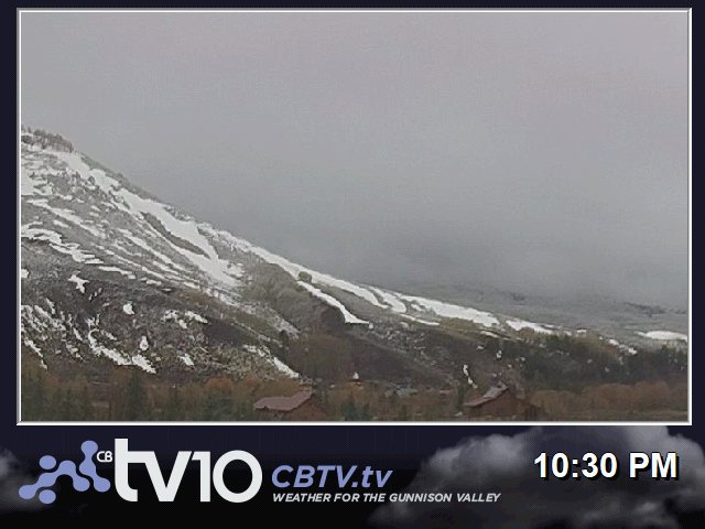


Snow for today.
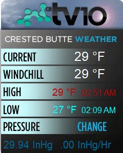
TV10 Crested Butte and Gunnison Valley Daily Weather Update- For Today- 1/6: This system was slow to spool up overnight but has hit it’s stride this morning and it looks like we will come in on the higher side of expectations. Look for the heaviest snow through the day today tapering into tonight as we see the pattern pivot west and gap waves with another set to move in early Monday. Look for 6-8 for CB and 4-6 for Gunni by Monday morning as the next round moves in. Travel on Monarch could be complicated this afternoon so watch for travel alerts.
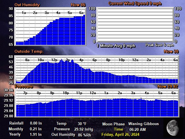
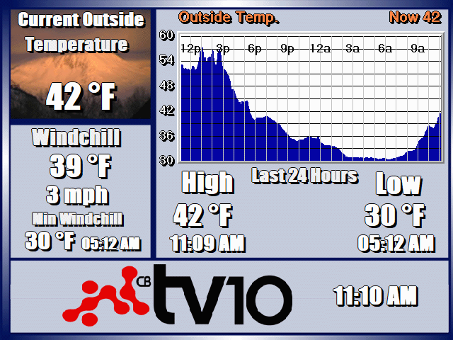
Temperatures: Overnight lows were mild with the snow with Gunni at 14 and 17 for CB. Highs will be in the mid 20’s valley wide with snow all day. Lows tonight could drop back to the single digits if we see a longer gap but will likely hover in the low teens.
Outlook: The pattern will pivot to the west for Monday and tee up round 2 moving through CO but this storm will be less impressive without some dynamic surprise. Milder temperatures will mean less efficient snow production limiting accumulations to 2-4 for CB and gusting winds will move it through faster. Skies clear for Tuesday with a gap between waves in a still developing pattern.
*Please note that the web cams below are not operated by CBTV and the consistency with which they refresh is beyond our control.